At Cividi, we are developing a platform for evidence based spatial planning (something @oleg has posted here earlier) and would like to hear your thoughts on this.
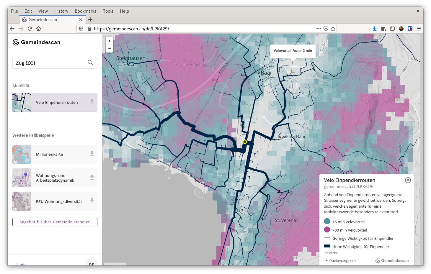
Version 1.0 is a viewer for styled Spatial Data Packages displaying geometry, meta data and a legend, grouped into workspaces. See some examples at our platform for municipal data projects, Gemeindescan.ch.
Spatial Data Packages are based on the Frictionless Data standards and are containers for GeoJSON + metadata. We have recently created a plugin for QGIS together with Gispo, our friends in Finland, that allows for easy publication for non-coders. You can get it here:
Further on the roadmap are collaboration tools to make working with spatial data as simple as handling PDFs, but without ending up in a pile of dry documents.
We’re excited to be part of the Opendata.ch community, and look forward to sharing our progress in this forum and upcoming events. Let us know what you think of this and if/how you would use this in your practice.
Regarding attribution: Good point. It is included in the Quellenangaben section of the legend box, however we will make sure to expose the attribution in the downloadable generated PNGs in a coming update to not get lost in other uses. Even though we like to think of the interactive web version which ensures attribution and sticks to the Frictionless Model as the canonical version other contexts and uses such as screenshots and print need to be accounted for.
More specifically: The underlying Data Package has as per spec a dedicated key for sources. Since the background is a layer or rather resource of a particular snapshot and not part of the platform we add the mentioned OpenStreetMap contributors attribution to our own snapshots there, which is exposed in the viewer posted above in the Quellenangaben section of the legend alongside the other datasets used in each Snapshot (aka Data Package).
A simple option could be to concatenate the source title strings into a classical leaflet attribution overlay. Or what would you see as a good way of adding it here?
It is included in the Quellenangaben section of the legend box …
Yes - but “Quellenangaben” seems to be only displayed if there’s a legend - and there’s only a legend if Gemeindescan has data for that county. If not there’s no legend - and therefore no Quellenangaben - there’s no attribution for the OSM basemap, like here dføur
A simple option could be to concatenate the source title strings into a classical leaflet attribution overlay.